
Dr Jan Francke
Dr Jan Francke
Groundradar Inc and Geolitix Inc, Victoria, Canada
Overview
GPR is now a mature near-surface tool for engineering and environmental applications, yet its capabilities extend far beyond traditional shallow investigations when appropriately configured and deployed. This half-day intense workshop presents a unified, physics-based approach to GPR that bridges the gap between engineering-scale imaging and deeper mineral exploration applications, with an emphasis on practical implementation, system design, and data interpretation.
The workshop begins with an overview of electromagnetic wave propagation in the subsurface, focusing on dielectric properties, signal attenuation, and the fundamental controls on resolution and penetration. Rather than treating GPR as a “black box,” participants will develop an operational understanding of how frequency selection, antenna configuration, and acquisition geometry directly influence data quality and depth of investigation across different geological environments.
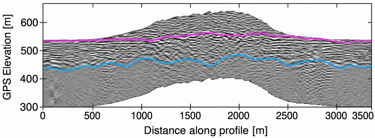
Building on this foundation, the course explores advanced acquisition strategies for challenging conditions, including conductive overburden, lateritic terrains, and variable moisture regimes. Particular attention is given to low-frequency GPR systems and their role in extending depth penetration for mineral exploration targets such as clay-hosted deposits, pegmatites, and stratigraphic interfaces. Case studies drawn from international projects illustrate how GPR can be successfully deployed in environments traditionally considered unsuitable for the method.
A significant portion of the workshop is dedicated to data processing and interpretation workflows. Participants will be guided through practical approaches to time-zero correction, gain application, filtering, and noise suppression, followed by more advanced techniques including attribute analysis, horizon tracking, and integration with other geophysical datasets. Emphasis is placed on rapid, field-adaptable interpretation strategies that allow informed decision-making during acquisition, rather than relying solely on post-processing.
The workshop also examines the integration of GPR with complementary methods such as electromagnetic locating (EML) and time-domain electromagnetic (TDEM) systems, particularly in the context of large-scale infrastructure mapping and subsurface characterisation. Emerging technologies, including robotic deployment platforms and cloud-based processing environments, are introduced as pathways toward scalable and automated GPR workflows.
A final discussion will address the practical limitations of GPR and the importance of maintaining realistic expectations in both engineering and exploration contexts. The session will examine common instances of overselling, misapplication, and, in some cases, outright misleading claims that continue to affect the industry, including within the Australian market. By grounding capabilities in physics and field evidence, this discussion aims to equip participants with the knowledge needed to critically evaluate GPR proposals, avoid inappropriate use of the method, and communicate results with clarity and technical integrity.
Designed for both engineering geophysicists and mineral exploration professionals, this workshop provides a rare cross-disciplinary perspective on GPR, demonstrating how a single methodology can be adapted across a wide range of applications—from concrete inspection and utility mapping to deep geological investigations. Participants are encouraged to bring their own datasets for discussion, with opportunities for interactive. interpretation and problem-solving throughout the session.
What are the learning outcomes?
A complete understanding of the applications and limitations of GPR.
Who should attend?
Near-surface geologists, engineers and geophysicists.